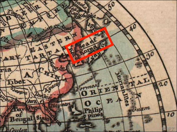
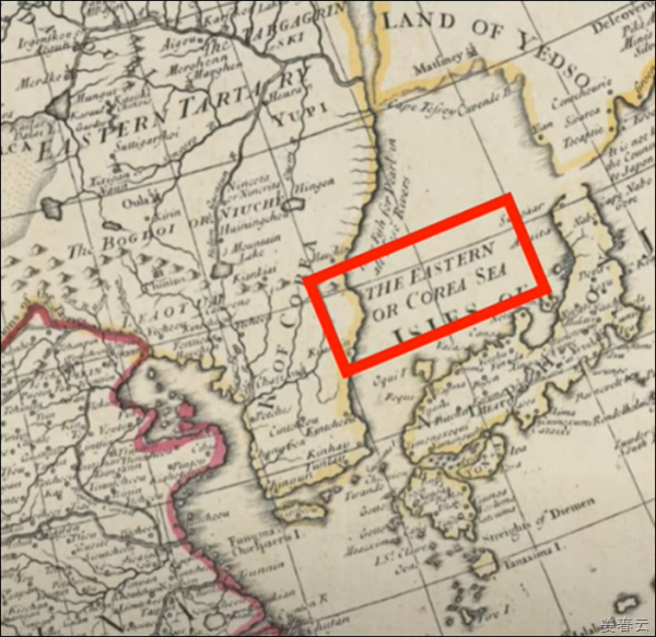
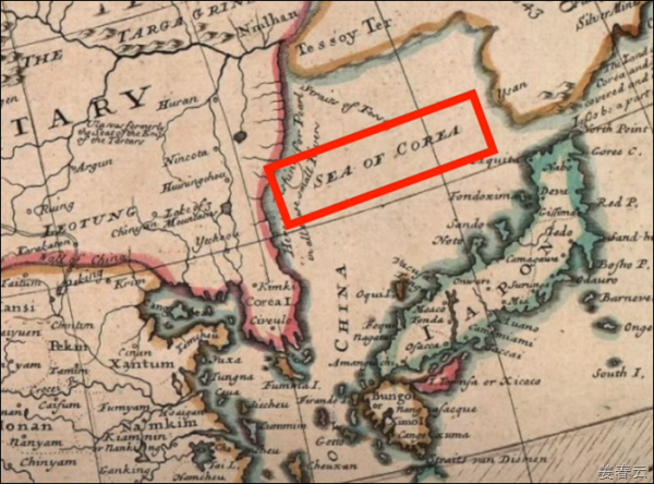
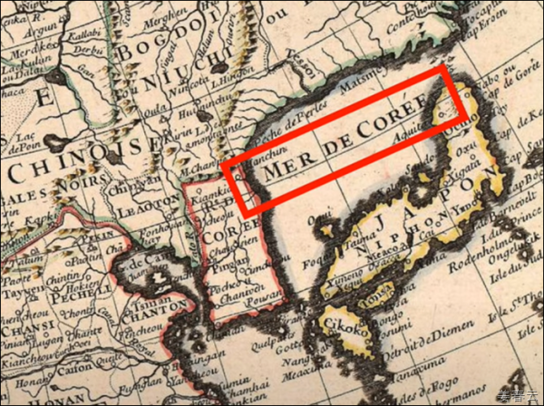
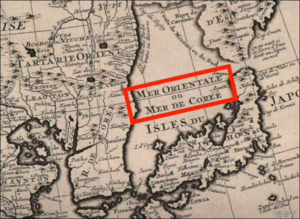
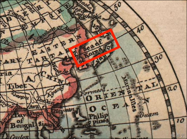
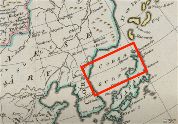
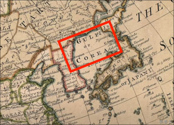
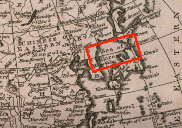
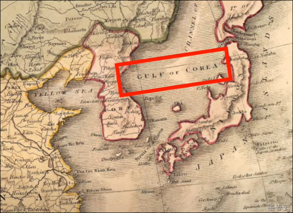
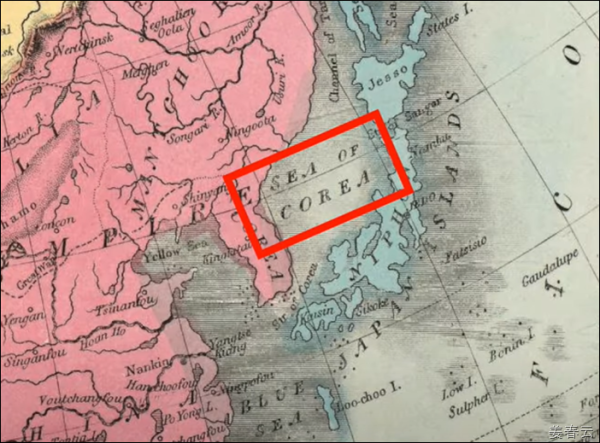
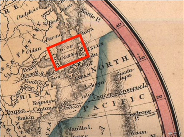
Ancient map showing Sea of Korea also known as Gulf of Korea, Corea Sea, Mare Di Corai published on the map from year 1643 to 1851 | ||
| ||
| The Korean Peninsula, the Japanese archipelago, the Maritime Province of Maritime Province and Sakhalin Island are surrounded by controversy over their name. This sea is an area under the sovereignty and jurisdiction of four countries: the Republic of Korea, the Democratic People's Republic of Korea, Japan, and Russia, and consists of the territorial waters and exclusive economic zones of these coastal countries. The dispute is not about the names both sides use in Korea, but about standard names that are commonly used internationally. In Korea, they argue that the East Sea should be called as the "East Sea Sea" or "Sea of Korea" since it has been called historically. In contrast, Japan argues that "Sea of Japan" has been an internationally accepted name since the 19th century and should be used as it is. Meanwhile, the Democratic People's Republic of Korea insists that it be marked as "East Sea of Sea of Japan." However, since there is a lot of evidence that the region has historically been called "Sea of Korea" since the 16th century, it is right to designate it as "Sea of Korea" under international law.
Mare di Corai (Sea of Korea) - Dell'Arcano del Mare, Robert Dudley, UK, 1643
Above map is published at London, England in 1710
Above map is published in 1715 at London, UK.
Above map is published in 1721 at London, UK.
Above map is published at France in 1723
Above map is published at France in 1732
Above map is published at France in 1750
Above map is published at France in 1780
Above map is published at France in 1790
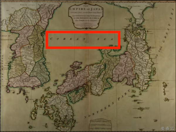
The East Sea is called the “Corean Sea” in the map titled, “The Empire of Japan divided into seven principal parts and subdivided into sixty-six kingdoms,” made in the U.K. in 1794. (image courtesy of the Seoul Arts Center)
Above map is published at France in 1800
Above map is published at Japan in 1809
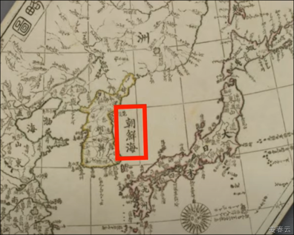
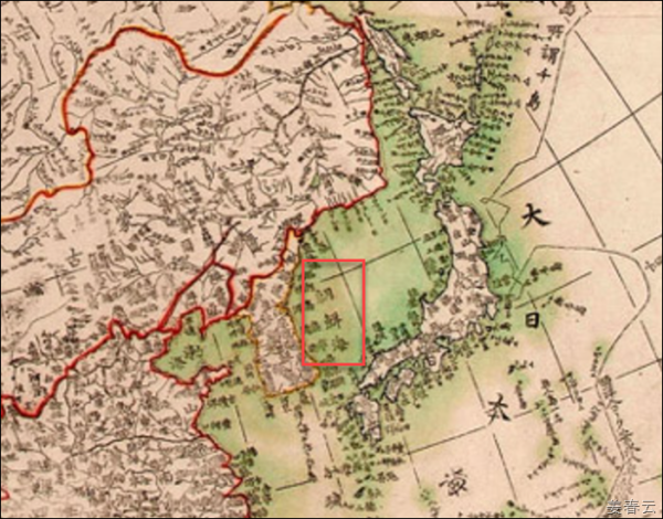
The East Sea was called the “Sea of Joseon” (朝鮮海) in the Shin-jung-man-guk-jeon-do (新訂萬國全圖), a map made in 1810 in Japan. (image courtesy of the Seoul Arts Center)
Above map is published at France in 1822
Above map is published at France in 1835
Above map is published at France in 1851 | ||
| | ||
| |